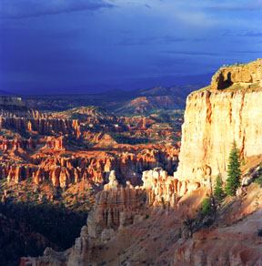
Bryce Viewpoint
You can barely see several visitors at the top of the viewpoint (on the right) as they check out the sunset. From the viewpoints to the bottom of Bryce Canyon is about 1,000 feet (300 meters).
Print No. A99-59-5
More Images of Sunsets
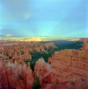
Anticrepuscular Rays, Bryce Canyon
Taken from Sunrise Point, this view of anticrepuscular rays is toward the east a few minutes after the Sun set in the west. These "twilight rays" are an unusual natural phenomenon, resulting from reflections high in the atmosphere. Although the rays appear to converge at the antisolar point (directly opposite the Sun's position), they are actually parallel (like railroad tracks appear to converge).
Print No. A99-59-7
More Images of Solar Rays
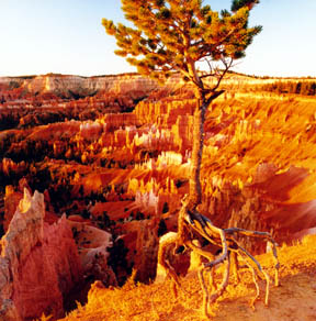
Walking Tree of Bryce Canyon
Clinging to the rim at Sunrise Point is a young pine tree. The exposed root system is about a foot high. That's how much of the rim has eroded at this location during the lifetime of the tree.
Print No. A99-60-6
Here is another example of a "walking tree" from the Grand Canyon.
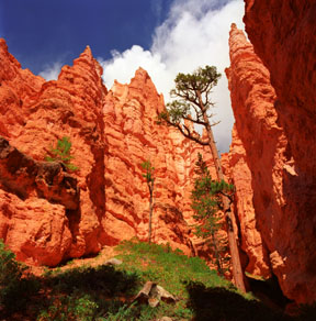
Navajo Loop Trail Hoodoos
Looking up amongst the hoodoos below Sunset Point provides a totally different perspective of their size. The douglas pine in this side canyon along the Navajo Loop Trail almost seems to compete with the hoodoos for sunlight.
Print No. A99-56-3
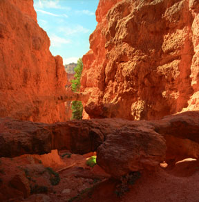
Twin Bridges
More rare and unusual than the vertical spires are these horizontal columns connecting adjacent hoodoos. The two seen in this view (one in the foreground and one in the background) occur along the same stratigraphic layer. These bridges are created between fins or hoodoos where erosion has worn all but the most cemented points along the most cemented layers.
Print No. A99-55-12
